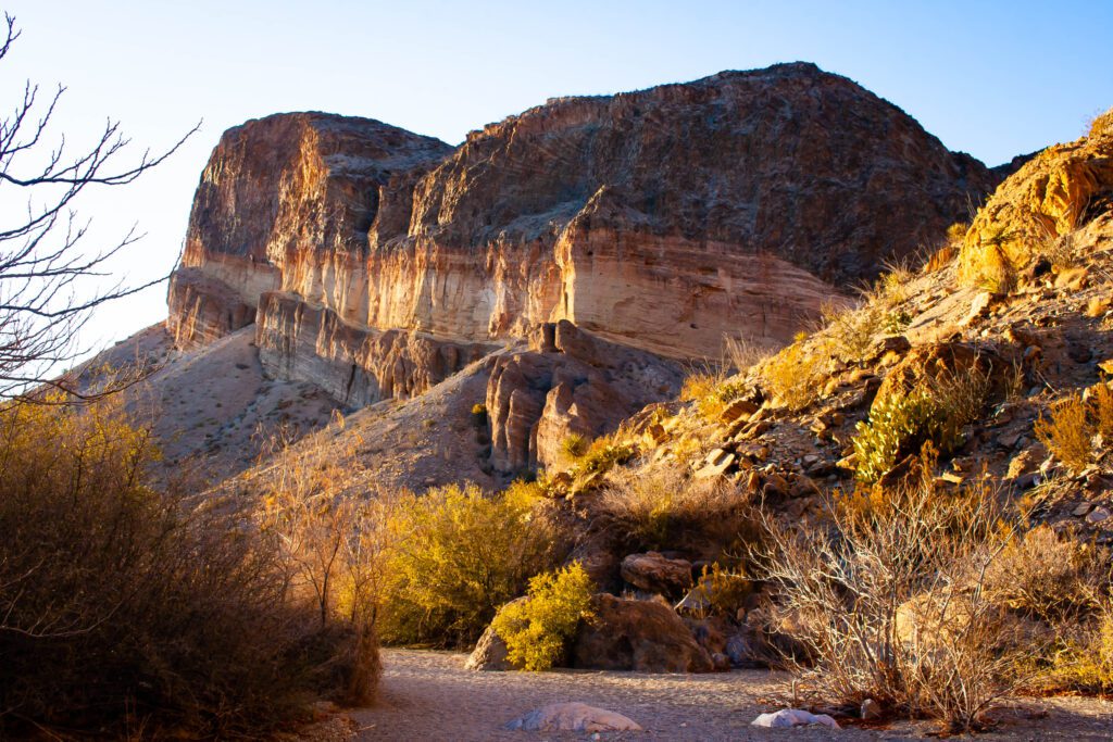
Big Bend National Park has tons of trails to choose from. Pick your poison. Just make sure it matches your skill level.
Depending on your length of stay, you’ll have to narrow things down. Let’s see if I can help with that!
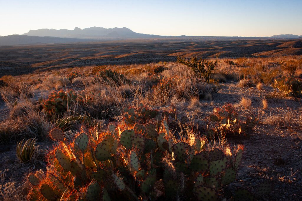
Big Bend is a place of drastic weather changes. Both temperature and storm wise. Monsoon season can cause flash flooding and water on roads to surge several feet!
Winter is warm by day and freezing at night. Elevation and shaded areas remain cold in the mornings. Summer is blazing but nights can still be cold. Dress accordingly… or check out our trail apparel.
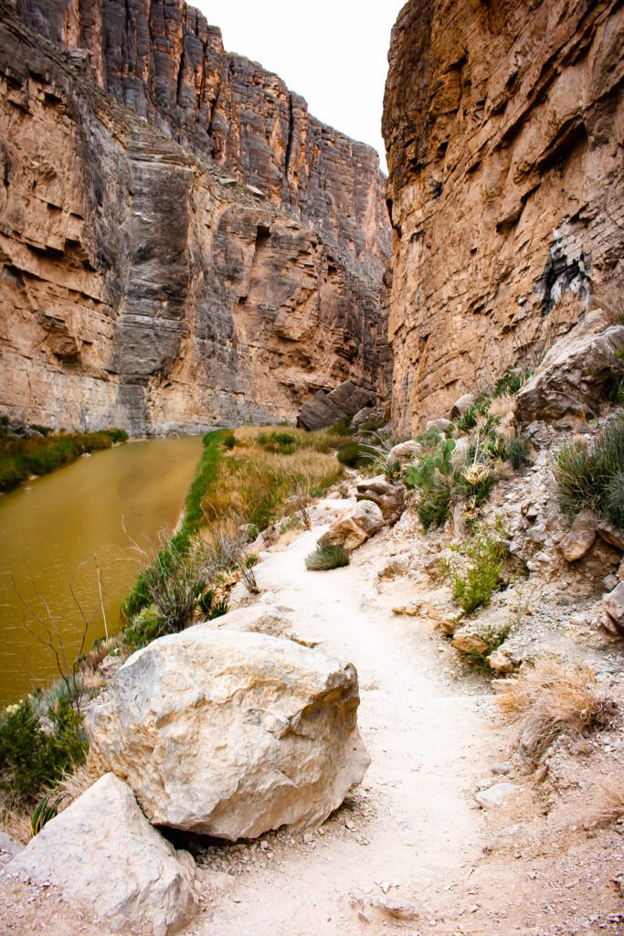
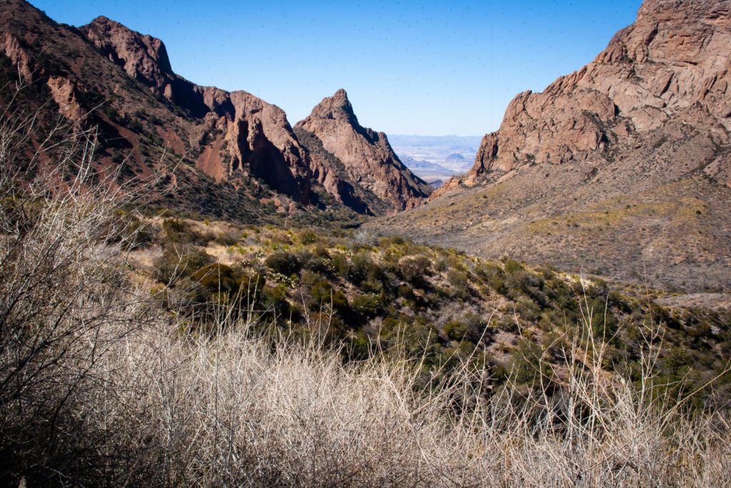
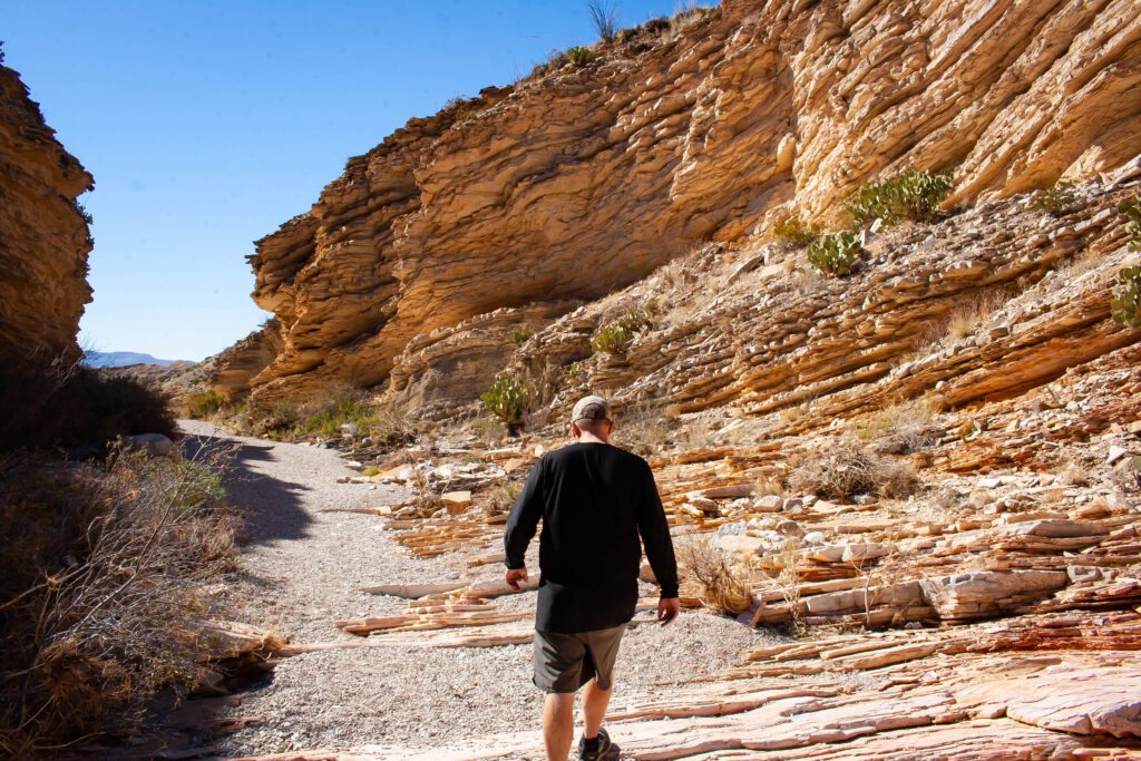
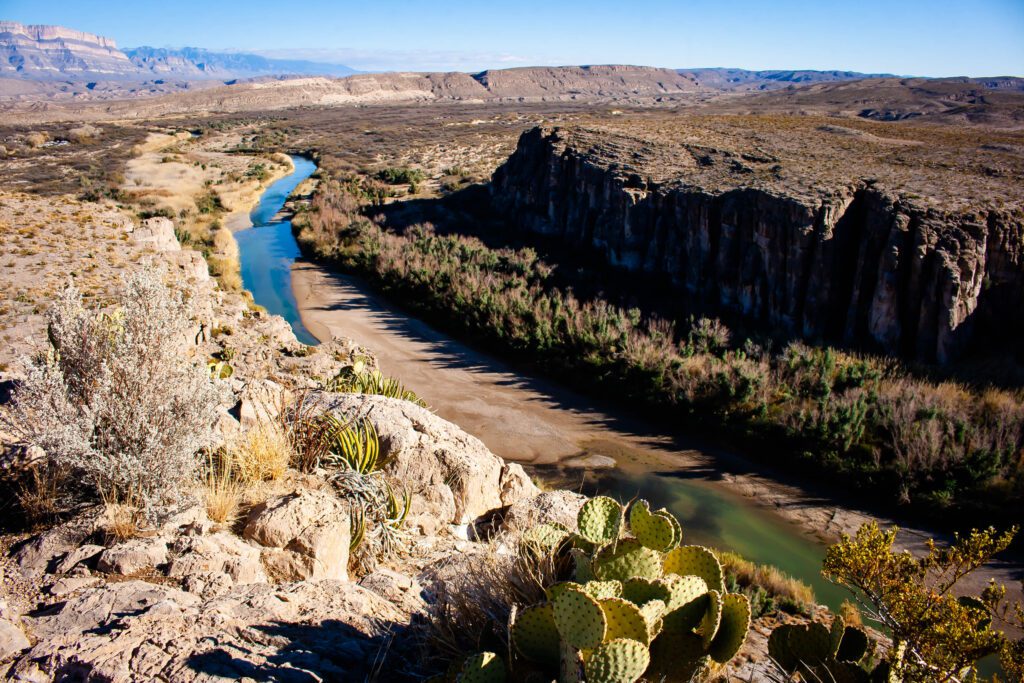
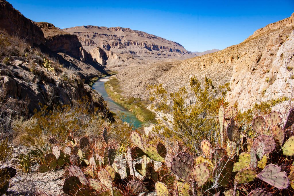
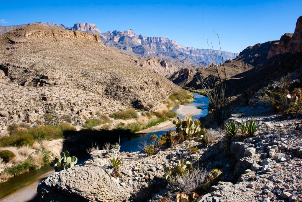
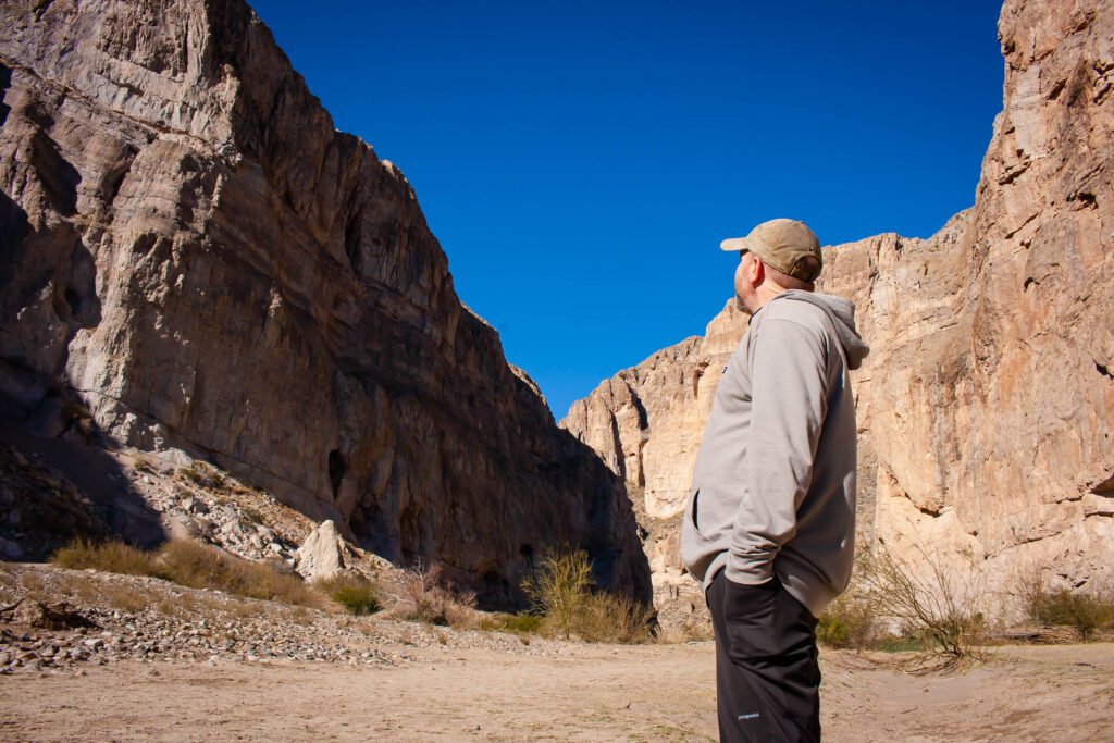
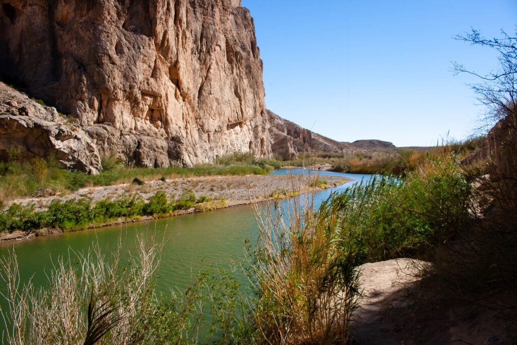
Santa Elena Canyon Trail
This is a neat little trail that takes you back along the right side of Santa Elena Canyon.
About 500 feet from the parking lot, you have to cross water. I was there at record low levels and still got wet up to my knees. It looks like people cross further up to the right to avoid this.
Then there’s a paved switchback that takes you up this view.
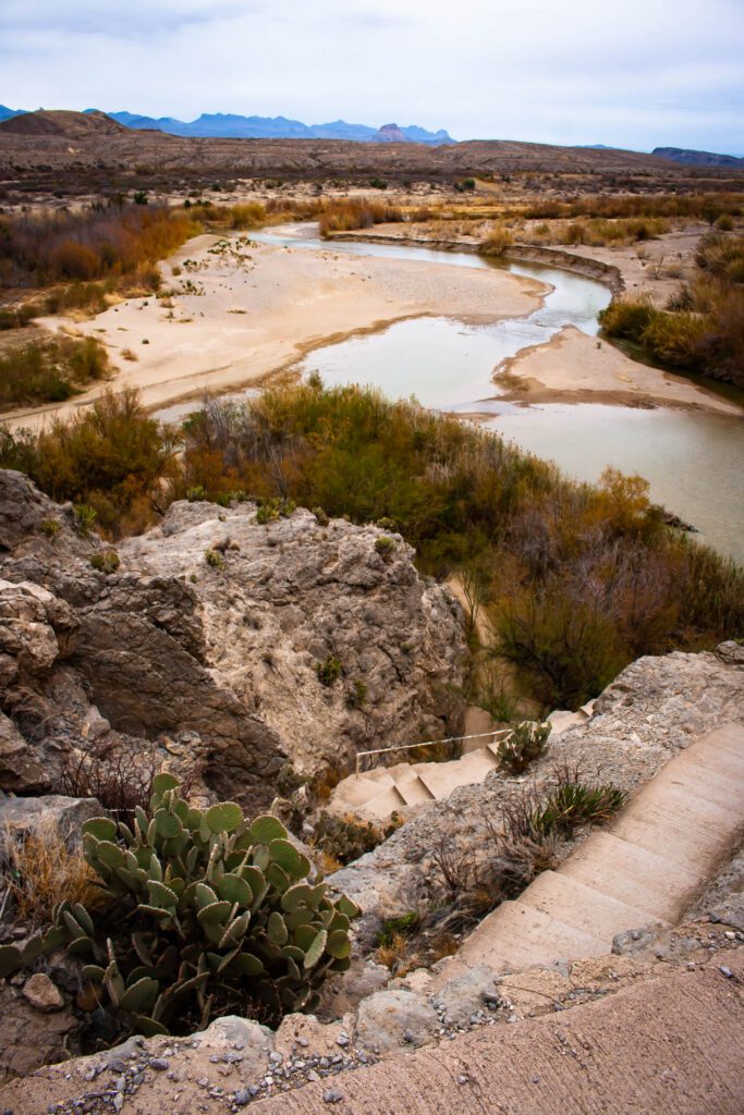
From there you descend among boulders and eventually end up in a tall grassy area, which I absolutely loved. You’ll know when you are at the end because you can’t go any further.
There are a few places you can access the water along the way.
Check out AllTrails for the trail map, profile and more info.
Santa Elena Canyon Trail Stats
Distance: 1.43 miles
Elevation Gain: 118 ft
Difficulty: Easy
Parking & Trailhead: GPS 29.167316, -103.610528
Our Rating: Pretty Cool & Fun
Curious about what lies up around the river bend? You might want to explore via kayak or paddle board.
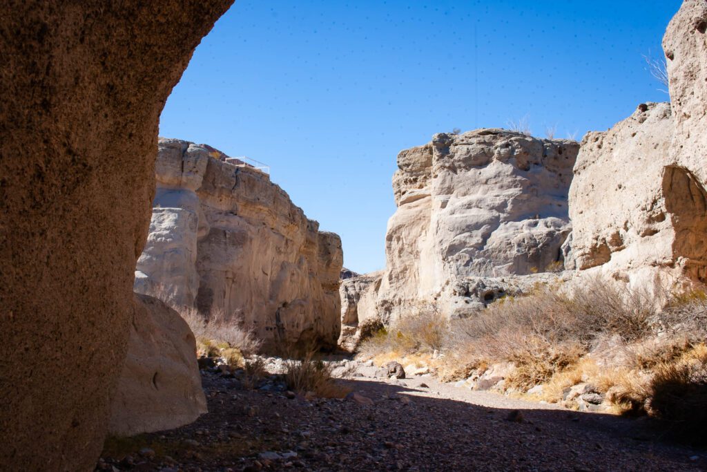
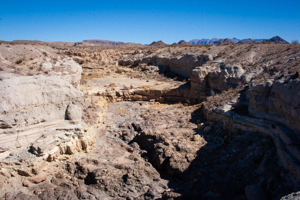
Tuff Canyon Trail
This is a short exploration of a canyon. If you go the whole way to the end, you can actually scramble up on rocks and work your way out of the canyon instead of backtracking.
Check out AllTrails for the trail map, profile and more info.
Tuff Canyon Trail Stats
Distance: 1 mile
Elevation Gain: 112 ft
Difficulty: Easy
Parking & Trailhead: GPS 29.149559, -103.487025
Our Rating: Pretty Cool
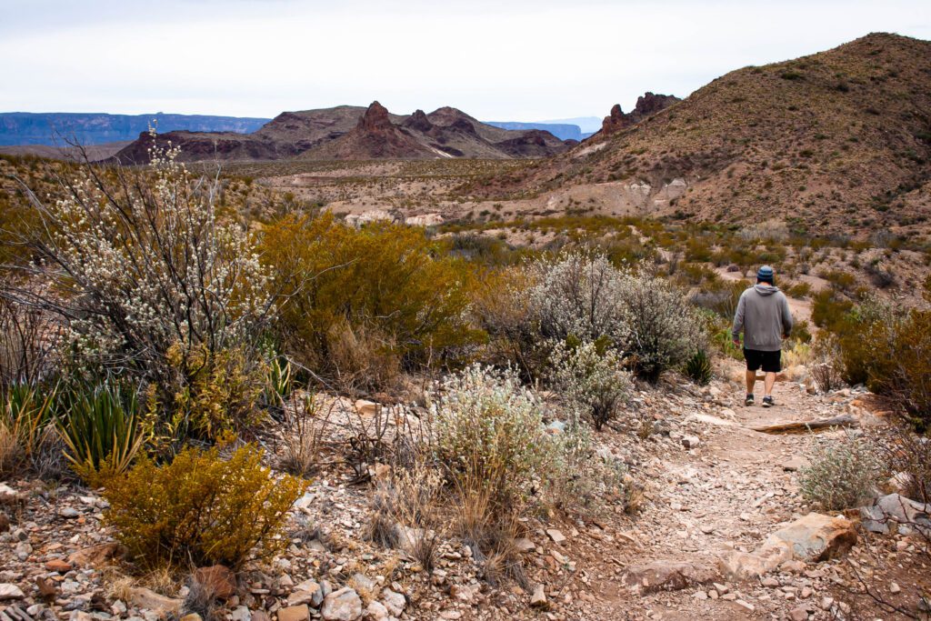
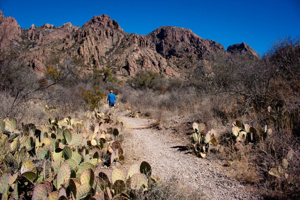
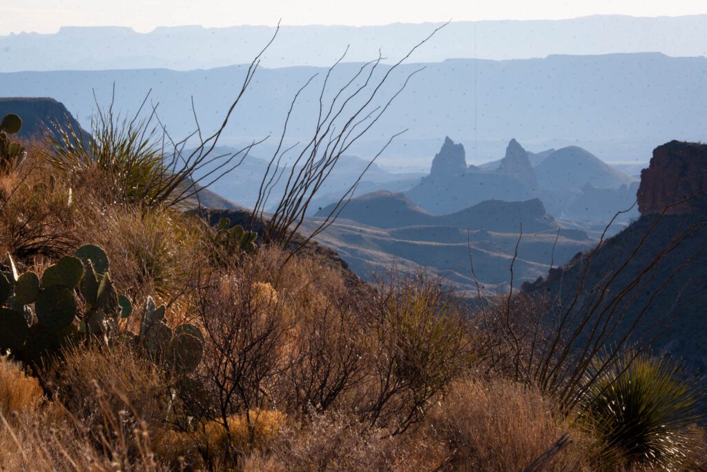
Mule Ears Trail
You’ll start descending from the parking lot along a rocky path.
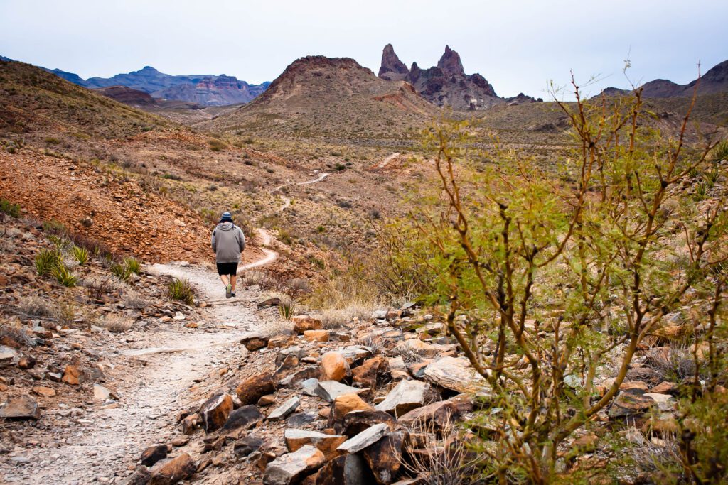
Then the trail levels out. Your eyes will be drawn to the distant jutting rock formations and plants surrounding you. And you seriously can’t miss Mule Ears.
If you hike to the spring and back, it’s only 3.9 miles and 410ft of elevation gain. I regret not going the whole way out to see Mule Ears from the back side.
Turn around wherever you want. Just make sure you don’t assume the trail ends or you’ll end up way out on Smoky Creek or Dodson trails.
The views on the way back close to the parking lot are pretty neat.
Check out AllTrails for the trail map, profile and more info.
Mule Ears Trail Stats
Distance: 7.15 miles
Elevation Gain: 1,022 ft
Difficulty: Easy to Moderate
Parking & Trailhead: GPS 29.1665, -103.43527
Our Rating: Enjoyable
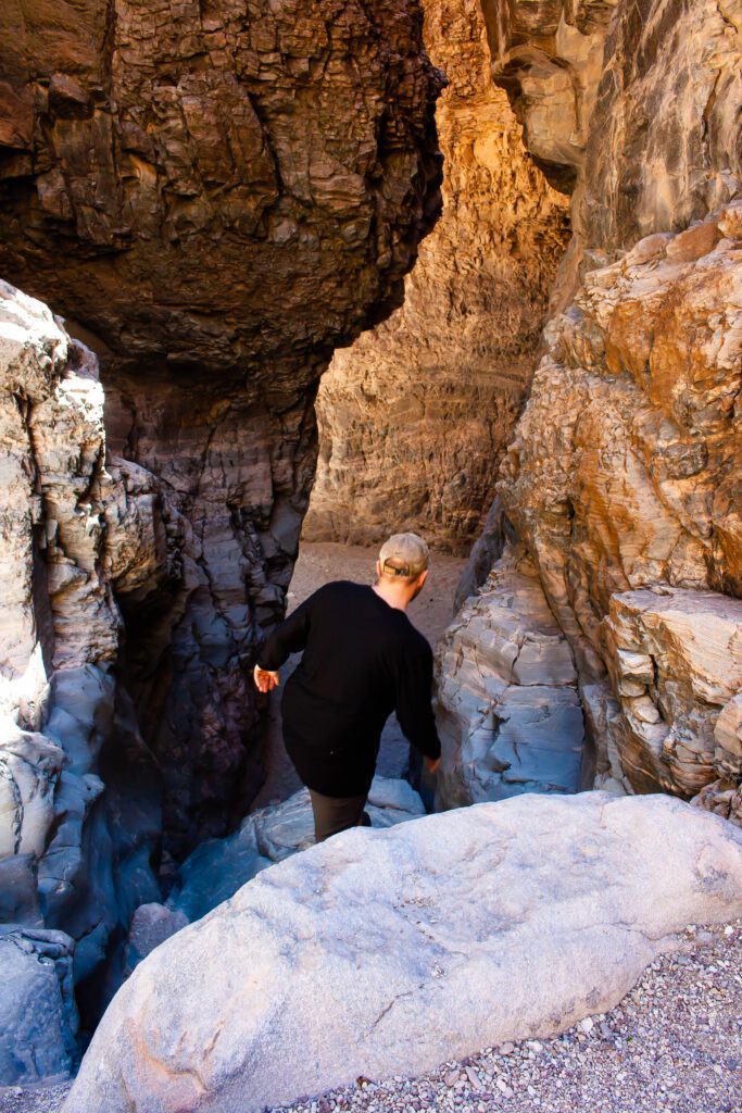
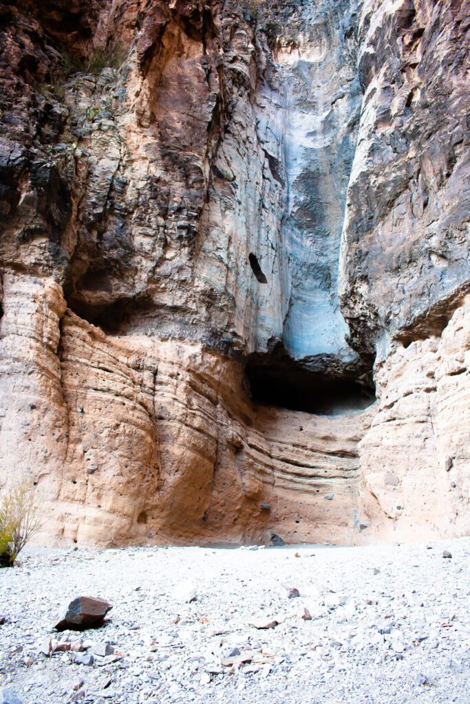
Upper Burro Mesa Pour-Off Trail
This trail was so freaking cool. It’s one of our favorites.
You descend down a wash that eroded into a canyon. There’s tons of interesting rocks. And we heard a lot of wildlife lurking around. I wouldn’t be surprised to see a mountain lion.
Towards the end, you can scramble down and explore before the big pour-off. We slid down on our butts and had fun climbing back up.
This was one of our favorite places in the whole park. Much better than the end of The Window Trail. And with zero crowds.
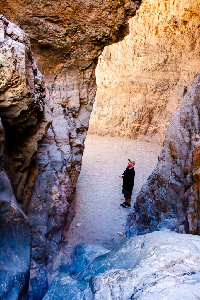
A ranger told us this is one of the better trails, but they don’t tell people because the parking is limited. What?!?!
Check out AllTrails for the trail map, profile and more info.
Upper Burro Mesa Pour-Off Trail Stats
Distance: 3.5 miles
Elevation Gain: 459 ft
Difficulty: Easy to Moderate
Parking & Trailhead: GPS 29.229480, -103.377703
Our Rating: Awesome & Fun
Lower Burro Mesa Pour-Off Trail
I’m glad we showed up at sunset because the rocks were glowing! The trail is super short but I liked meandering through the scrubby hills on the way to the focal point.
The pour-off at the end… Eh, I don’t really see what all the fuss is about.
Although I bet it’s mesmerizing during a monsoon. But the trail’s in the wash so I’m pretty sure that would be dangerous AF.
Check out AllTrails for the trail map, profile and more info.
Lower Burro Mesa Pour-Off Trail Stats
Distance: 1 mile
Elevation Gain: 144 ft
Difficulty: Easy
Parking & Trailhead: GPS 29.234084, -103.407101
Our Rating: Eh, It’s Okay
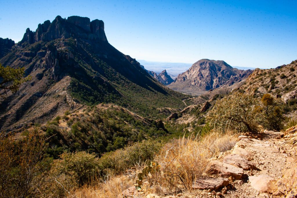
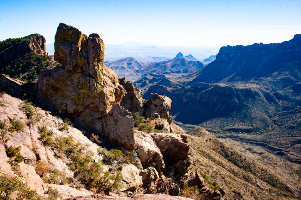
Lost Mine Trail
I’m going to tell you right now. You are not allowed to visit Big Bend without doing this hike. It’s on the favorite list for a reason.
The views start at the beginning. And switchbacks make the climb gradual.
The views get better with each leg up until you reach the top. Then they suck. Push past the cool colored striations on your left until it really opens up.
You’ll find sock-knock-off views and some rock formations to climb. I could’ve spent the whole day up there exploring and gawking.
The views look down into Chisos Basin from one direction and Pine Canyon in the other.
Check out AllTrails for the trail map, profile and more info.
Lost Mine Trail Stats
Distance: 4.8 miles
Elevation Gain: 1,131 ft
Difficulty: Moderate
Parking & Trailhead: GPS 29.274442, -103.286510
Our Rating: Freaking Awesome
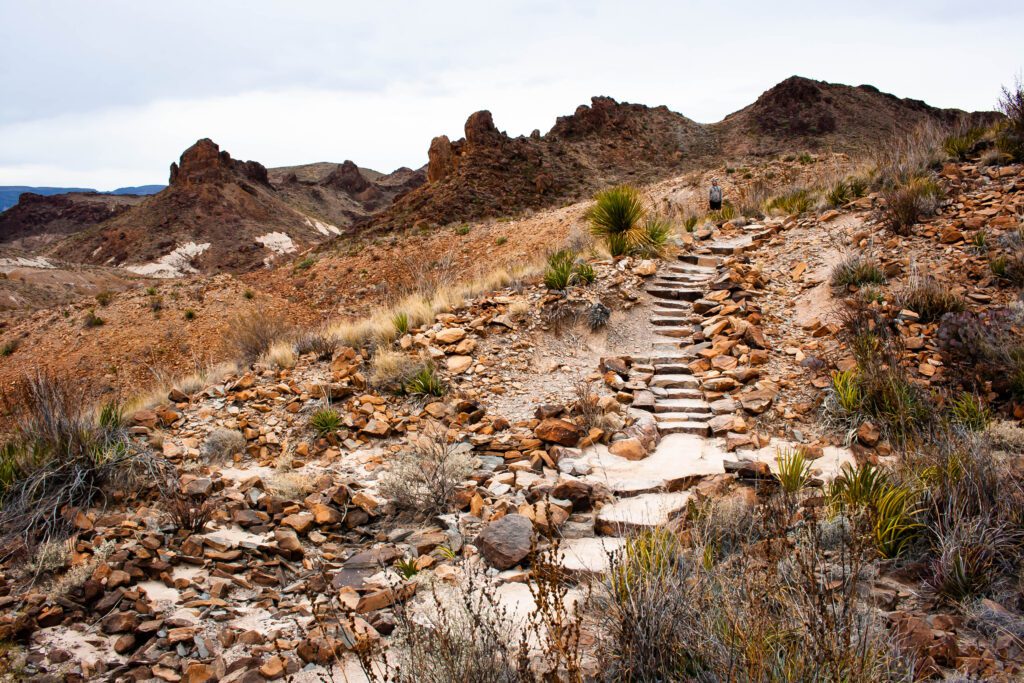
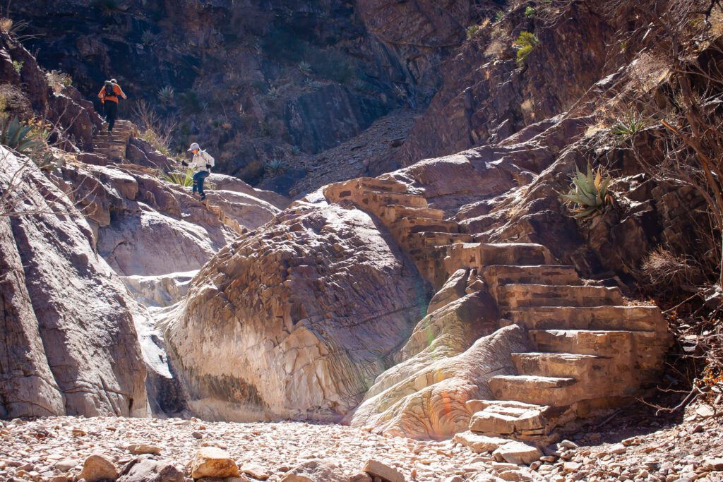
The Window Trail
The best views of the Window are from up near the parking lot. We liked other trail aspects way more than the lookout at the end.
The trail switchbacks down into the valley. There isn’t much to look at other than the impressive rock formations that surround the basin.
You pass a lot of shrubby desert vegetation before reaching the shade of tree canopies. We heard tons of birds fluttering around.
The best part of the trail is when you get down into the wash. We loved the stairs the park incorporated into the rocks.
The Window lookout is at the end — you’ll probably have to share it with a bunch of other people.
Then it’s all uphill on the return.
Check out AllTrails for the trail map, profile and more info.
The Window Trail Stats
Distance: 5.7 miles
Elevation Gain: 961 ft
Difficulty: Moderate
Parking & Trailhead: GPS 29.270184, -103.301022
Our Rating: Kinda Cool & Enjoyable
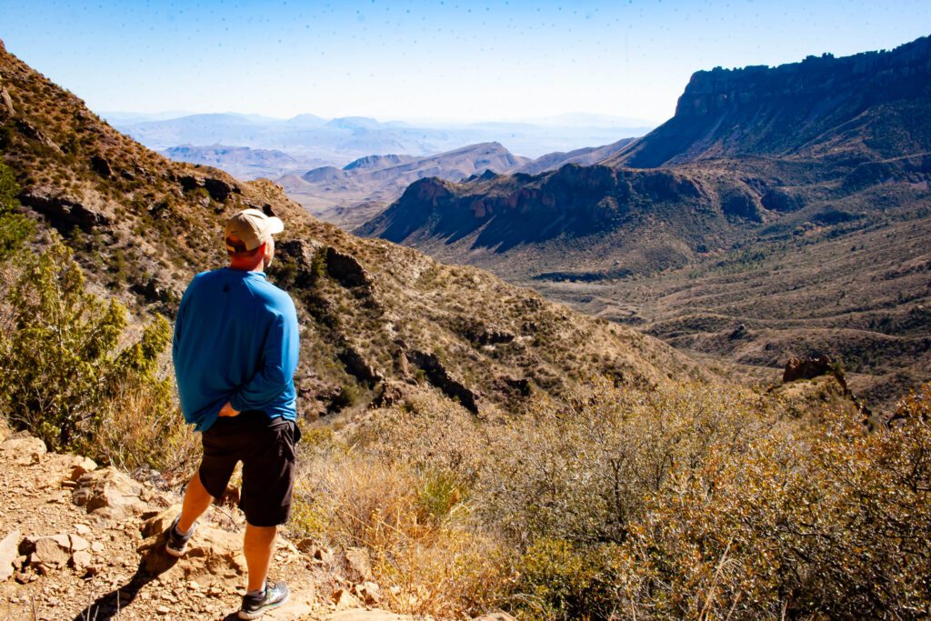
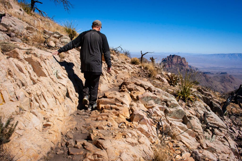
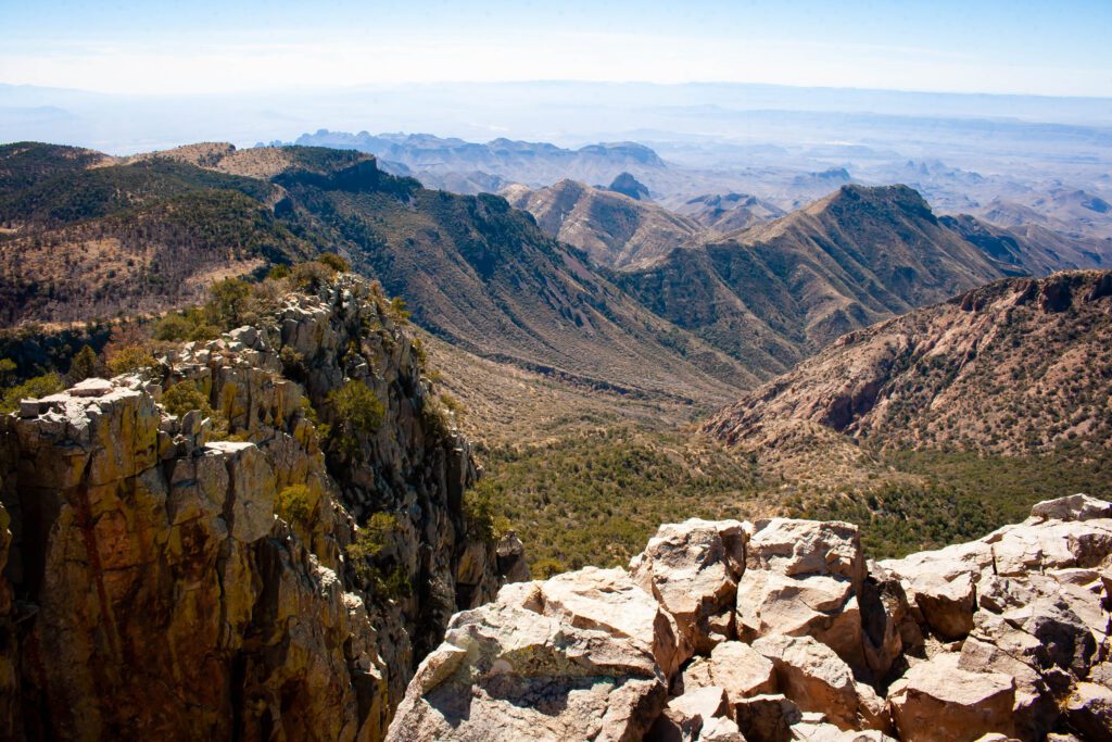
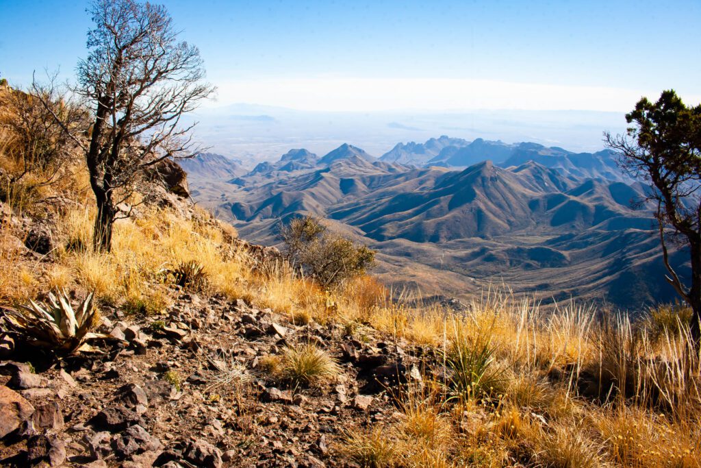
Emory Peak Trail
This trail has a lot of miles and elevation gain. If you start early in the morning, be prepared for chilly temps because you’ll be hiking the shady side of the basin.
Once you get above the tree line, the views open up. Then you climb more along a ridge all the way to the haystack that is Emory Peak.
We lost the trail towards the top because of multiple paths. Aim for the most worn. (If you can tell — cuz I couldn’t.)
Be ready to use all 4 limbs to completely summit the peak. It looks worse than it actually is. But if you’re scared of heights, you don’t have to climb up.
Once on top, you’ll be rewarded with 360 degrees of views.
Tip
Instead of hiking to Emory Peak and back, you might want to push on to South Rim. It shares a large portion of the same trail. This saves about 7 miles vs doing them separate.
Check out AllTrails for the trail map, profile and more info.
Emory Peak Trail Stats
Distance: 10.2 miles
Elevation Gain: 2,520 ft
Difficulty: Hard
Parking & Trailhead: GPS 29.270184, -103.301022
Our Rating: Freaking Awesome
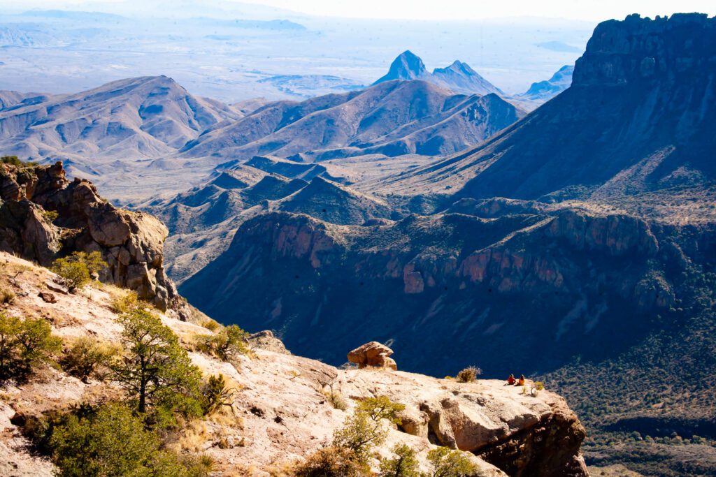
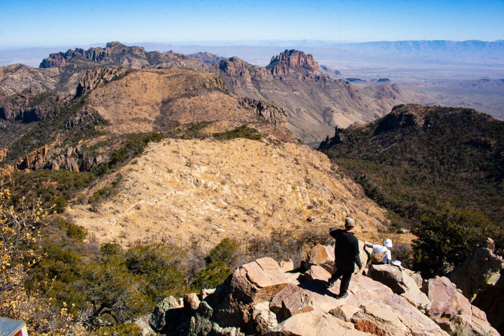
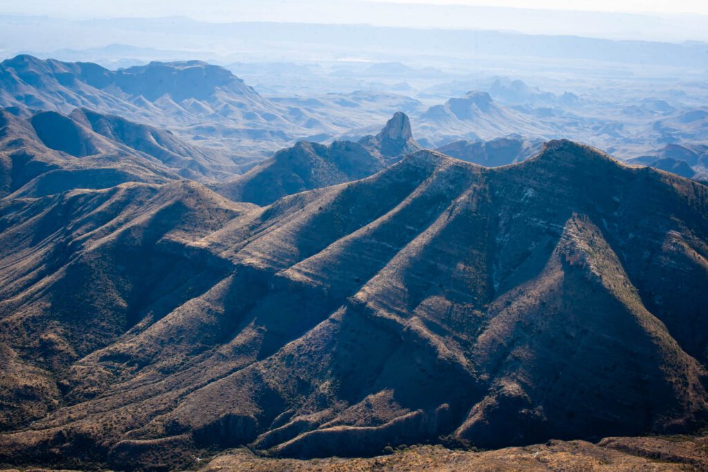
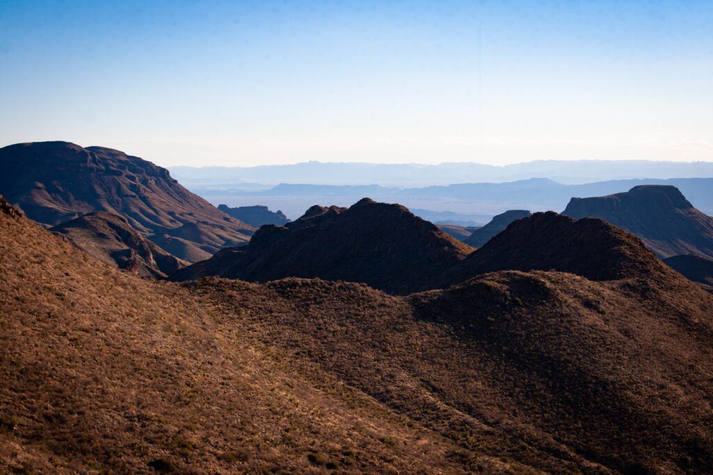
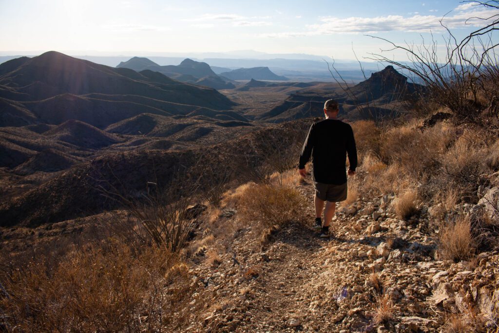
South Rim Loop Trail
This is another one of our favorites. From desert to rocks, forest, mountains and washes. This hike gives you a little bit of everything.
But you have to clock miles and traverse through forest and washes to get to the really good parts.
Cuz South Rim has some epic views. Seriously, breathtaking.
When you hit the rim, you can see out for miles. Jutting ridges are clustered together followed by flat desert with more mountains in the distance… beyond amazing.
If 12 miles is a bit much or you really want to soak in those views, turn it into an overnight backpack hike. At that point you might as well add on the 3 mile detour to Emory Peak.
Reserve one of the sites near the rim so you can bask in the glory of sunset/sunrise. Just make sure you’re prepared for drastic temperature fluctuations.
Check out AllTrails for the trail map, profile and more info.
South Rim Loop Trail Stats
Distance: 12.2 miles
Elevation Gain: 2,001 ft
Difficulty: Hard
Parking & Trailhead: GPS 29.270184, -103.301022
Our Rating: Awesome
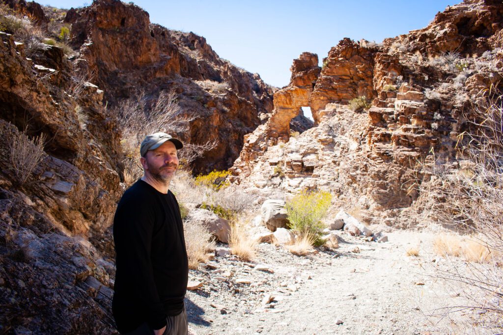
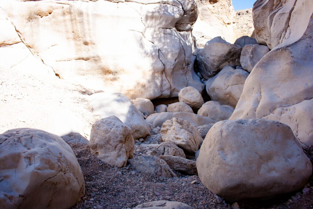
Ernst Tinaja Trail
If you plan to drive out to the trailhead, make sure you have a high clearance vehicle. This is supposed to be the worst unpaved road in the park.
We road bikes out the 6 miles. It was really bumpy and washed out. But so worth it! Another favorite.
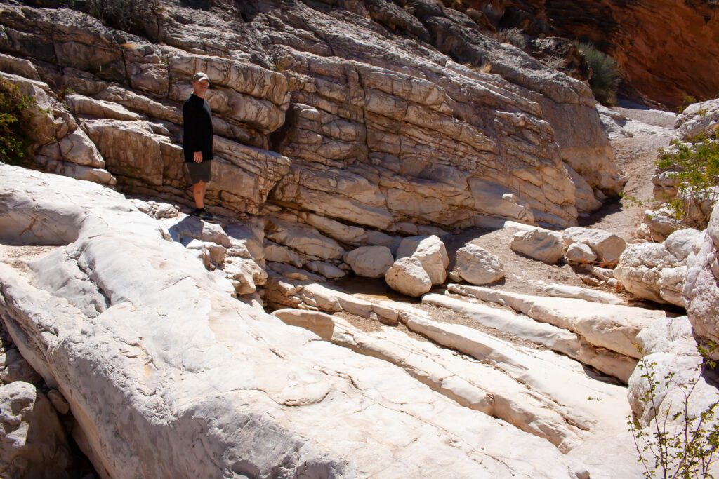
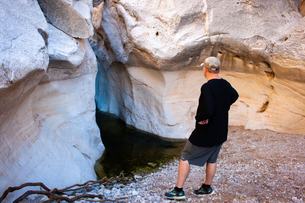
The actual trail is in a wash. Not far from the trailhead you start to see interesting canyon walls. And then the amazing pink formations at Ernst Tinaja.
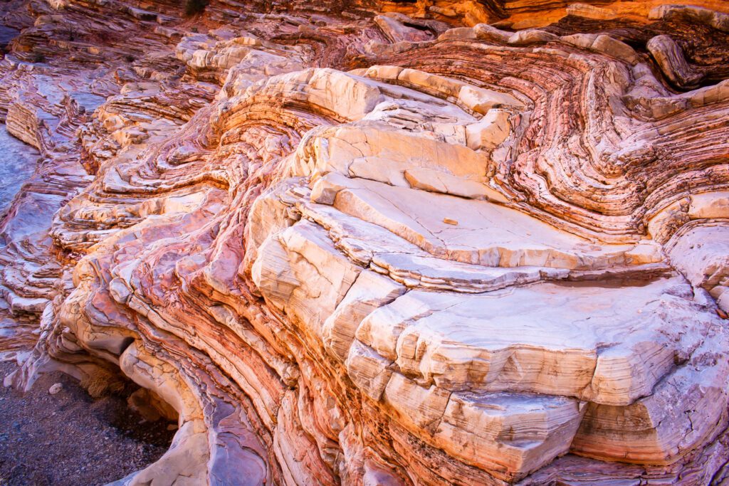
The rocks change further up the canyon to smooth white boulders.
It was a lot of fun climbing around and exploring as far back as we could go before hitting a steep wall and creepy dark water.
This is another one of our favorite trails in Big Bend.
Check out AllTrails for the trail map, profile and more info.
Ernst Tinaja Trail Stats
Distance: 1.1 miles
Elevation Gain: 111 ft
Difficulty: Easy
Parking & Trailhead: GPS 29.253302, -103.017952
Our Rating: Really Really Cool
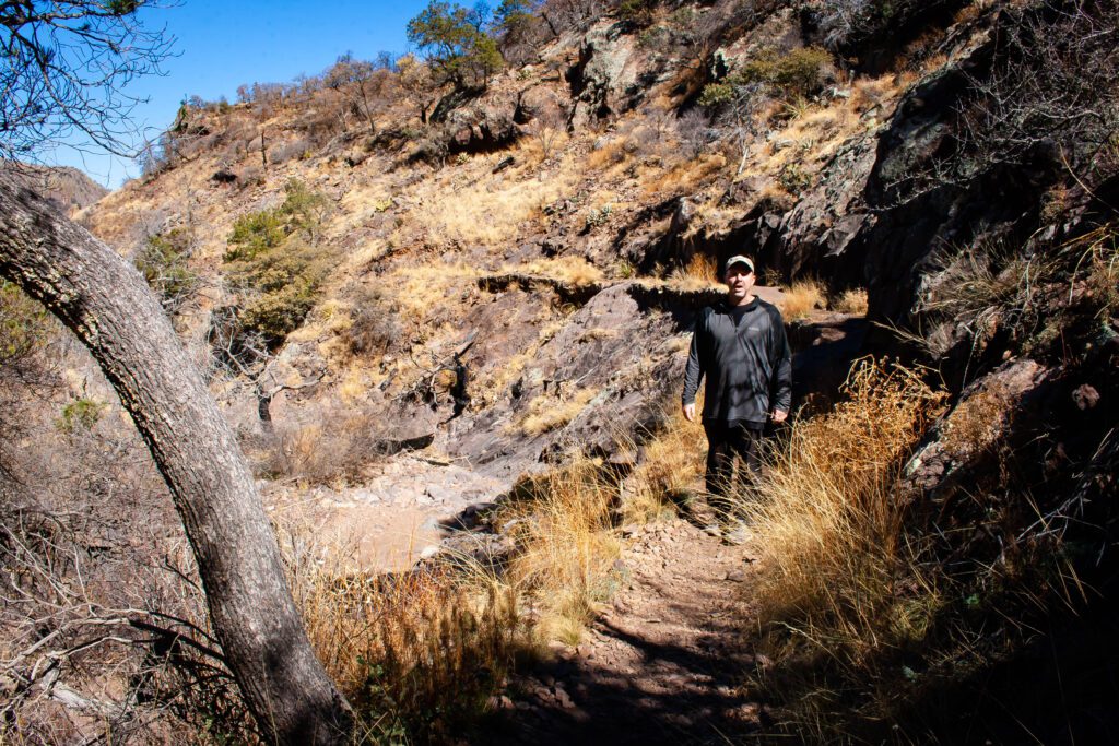
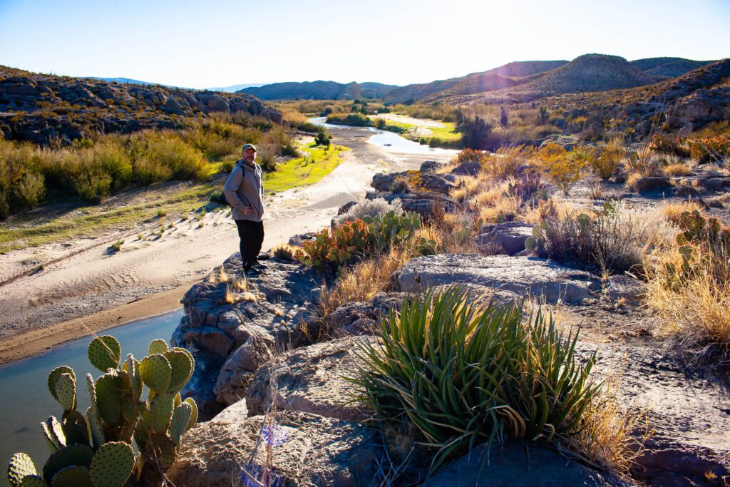
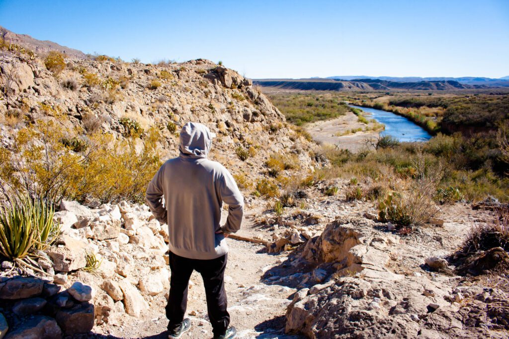
Hot Springs Canyon Trail
It’s up to you whether you start from the hot springs parking lot or from the Rio Grande Village area. We chose Rio Grande Village because we were in that area and wanted to avoid a dirt road.
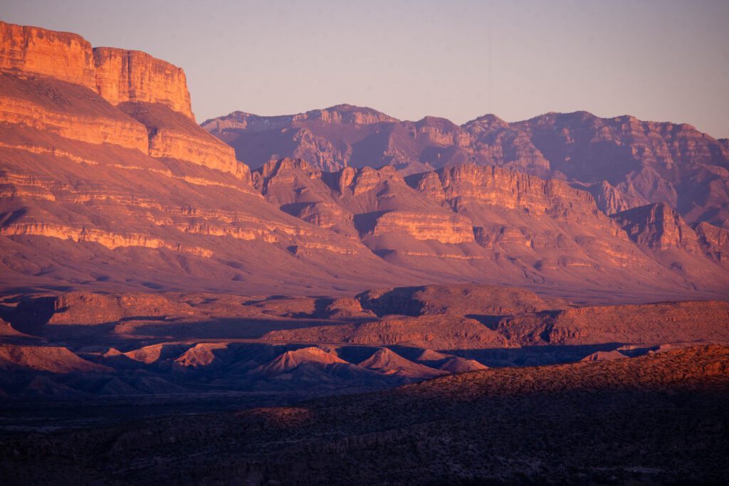
Right out the gate you begin climbing. That elevation gain gives you amazing views of the distant rockfaces, which turn pink during sunset.
The trail moves closer to the river and gives you a view down into a canyon.
You pass a few other hills and crevices before it levels off. This allows you to see far and wide. The whole way over to the Chisos Basin mountains in the distance.
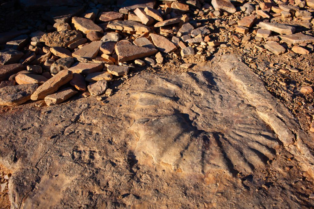
The hike works its way back to the Rio Grande. There’s tons to see including a HUGE fossil on the walking path. At one point the trail moves into a really cool area of rocks with glacial potholes.
It’s up to you whether you want to take the high trail or lower first. They connect eventually but the lower will get you to the hot springs and a historic building faster.
If you want to get in the hot springs, bring towels and a bathing suit. It was packed when we passed so we came back a different day.
Check out AllTrails for the trail map, profile and more info.
Hot Springs Canyon Trail Stats
Distance: 5.5 miles
Elevation Gain: 921 ft
Difficulty: Moderate
Parking & Trailhead: GPS 29.185943, -102.971730
Our Rating: Awesome
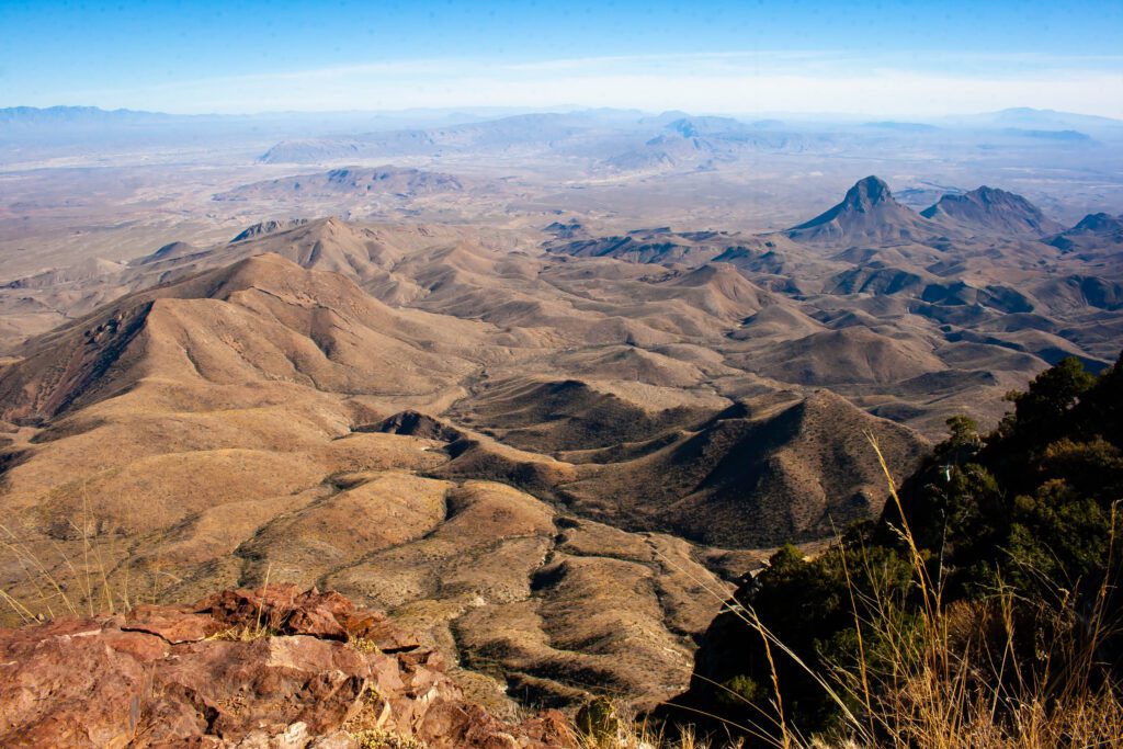
Marufo Vega Trail
Epic views. But this trail isn’t for the faint of heart.
It has comparable distance to the South Rim Loop, but with steeper inclines. Seriously, the profile shows 25% grade in some areas.
And omg… the beginning walk up the wash is painfully slow. Then you do some hefty climbing and have to choose which way to go at the fork.
We recommend counterclockwise despite convention. Better views and you don’t have to go up the steep part with ultra loose gravel.
Once you get to the bottom of the wicked steep loose gravel part (or are about to go up that nonsense), you get some beautiful views of the Rio Grande.
The trail goes along the river before angling away. We had some issues picking the trail back up across washes. I definitely suggest an offline map to avoid getting lost on this beast of a hike.
The left fork goes up through a rocky canyon that’s shaded in the afternoon. We thoroughly enjoyed climbing up this part vs going down.
Jockeying for the top spot in our favorites list, the views and challenge had us at hello.
Check out AllTrails for the trail map, profile and more info.
Marufo Vega Trail Stats
Distance: 13.3 miles
Elevation Gain: 1,398 ft
Difficulty: Hard
Parking & Trailhead: GPS 29.199242, -102.928049
Our Rating: Freaking Awesome
Boquillas Canyon Trail
This is a pleasant little hike. Well, besides the taquito toting Mexican peddlers. It was awkward not having any cash and having to say no to so many of them.
The hike starts off on an incline up to a scenic view that I think has a better vantage point than the Boquillas Canyon Overlook.
There’s a section of lush greenery that feels out of place. Then you end up on a big stretch of rocky shoreline. Tall grasses cover areas of the bank as you make your way into the canyon.
I’m not completely sure where the trail ends, but eventually you can’t go any further without getting wet. We explored a bit before turning back.
The views in reverse are full of hills rolling into Mexico and the Rio Grande. And this is what you see on the way down to the parking lot.
Check out AllTrails for the trail map, profile and more info.
Boquillas Canyon Trail Stats
Distance: 1.3 miles
Elevation Gain: 369 ft
Difficulty: Easy
Parking & Trailhead: GPS 29.200633, -102.919332
Our Rating: Pretty Cool
Future Plans
Grapevine Hills Trail
This is supposed to be a pleasant trail with a cool rock formation at the end. I just wasn’t sure it would be worth the effort to get there. Ernst Tinaja definitely was, so I prioritized that first.
We didn’t want to take our camper van down the 6.45 mile unpaved road after the nonsense with the road to the hot springs.
I still regret not riding my bike up Grapevine and hiking out to Balanced Rock. FOMO is a bitch even months after this trip has passed. I should have known better.
Check out AllTrails for the trail map, profile and more info.
Grapevine Hills Trail Stats
Distance: 2.0 miles
Elevation Gain: 246 ft
Difficulty: Easy to Moderate
Parking & Trailhead: GPS 29.410466, -103.207686
Our Rating: N/A
Pine Canyon Trail
I’m extremely curious about this trail because it goes into valley that you look down into from the Lost Mine Trail.
I’ve read that there is a waterfall at the end if you’re there during rainy season and you might see bears.
Again the issue would be getting to the trailhead since it’s back another dirt road. I found a parking spot a little ways down at 29.267352, -103.148902.
This would leave 6.25 miles of biking to the trailhead and 1,828 feet of elevation gain. Downhil on the way back would be nice, unlike Grapevine.
Check out AllTrails for the trail map, profile and more info.
Pine Canyon Trail Stats
Distance: 4.3 miles
Elevation Gain: 1,000 ft
Difficulty: Hard
Parking & Trailhead: GPS 29.267097, -103.227974
Our Rating: N/A
Blue Creek Canyon Trail
The tail pics look sweet. I’m thinking this would be a cool alternative to South Rim vs doing the loop out from Chisos Basin.
Picking up the western side of South Rim, it’s 16 miles with elevation gain of 3600ft. It would be about the same mileage of our hike that included Emory Peak, the North East Rim and South Rim.
Check out AllTrails for the trail map, profile and more info.
Blue Creek Canyon Trail Stats
Distance: 11.5 miles
Elevation Gain: 2,700 ft
Difficulty: Hard
Parking & Trailhead: GPS 29.216581, -103.369345
Our Rating: N/A
Dodson, Juniper Canyon, Blue Creek Loop
I think it might be even better to do an overnight backpacking trek that includes Blue Creek. If planned right, you could reserve a South Rim camping spot to catch sunset and sunrise before marching on.
We hiked 3 miles up the Dodson Trail, which was stunning at sunset.
I wanted to get a look at South Rim from below. Didn’t happen. You’d have to go out further. You can however see Mule Ears in the distance. Super cool!
I expect the views will be worth the long loop hike. Being among the ridges you can see from South Rim really piques my interest.
Dodson, Juniper, Blue Creek Loop Stats
Distance: 25.2 miles
Elevation Gain: 6,010 ft
Difficulty: Hard
Parking & Trailhead: GPS 29.216581, -103.369345
Our Rating: Awesome to N/A
Want More In Big Bend?
Need a planning guide? Cool cuz that’s kinda my jam. Info here.
Love taking photos? Check out my best photo ops in Big Bend post.
Want A Printable PDF For Trail Info?
I was thinking about making a printable PDF where each page has a trail’s pertinent info, map, profile and GPS trailhead.
If you like that idea, let me know in the comments.