It took me weeks to figure out where the best photo-worthy spots in Big Bend National Park might be. I spent hours creeping internet search results, social media and trail sites.
After spending two weeks in the park, I can tell you what I found. Some are popular no-brainers, but my list goes beyond what’s popular.
You have to hike to get to some of these, but only one of these requires a high-clearance vehicle to get the money shot. Let’s show you where to take epic photos that will make people jealous.
This list is photo focused. Looking for something else? Click over to our park planning info or our favorite trails list.
Park Wide
Wildlife
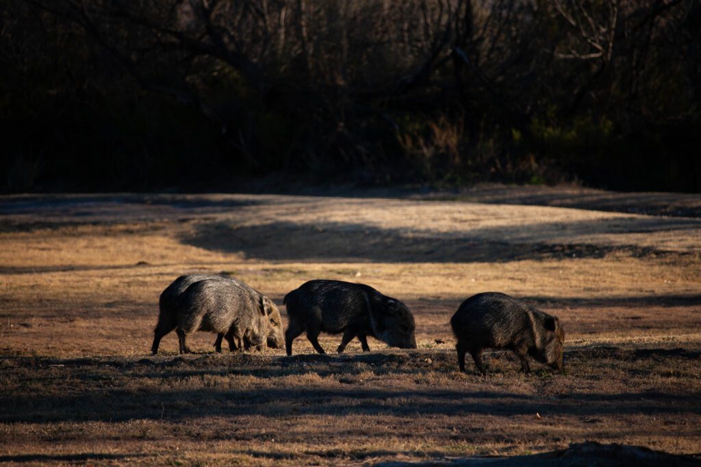
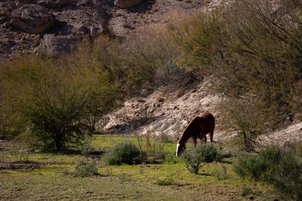
Big Bend National Park has many different ecosystems. With that comes biodiversity.
It’s incredible how many animals make this desert park their home. Outsider has a great animal summary. According to them, “Big Bend has more species of birds, bats, butterflies, and scorpions than any other national park in America”.
We saw javalina, wild horses, coyotes, rabbits, a mountain lion, an elk, snakes, lizards, frogs and birds. Had we not been so distracted by the grandeur of this park, we probably would have spotted more.
Plant Life
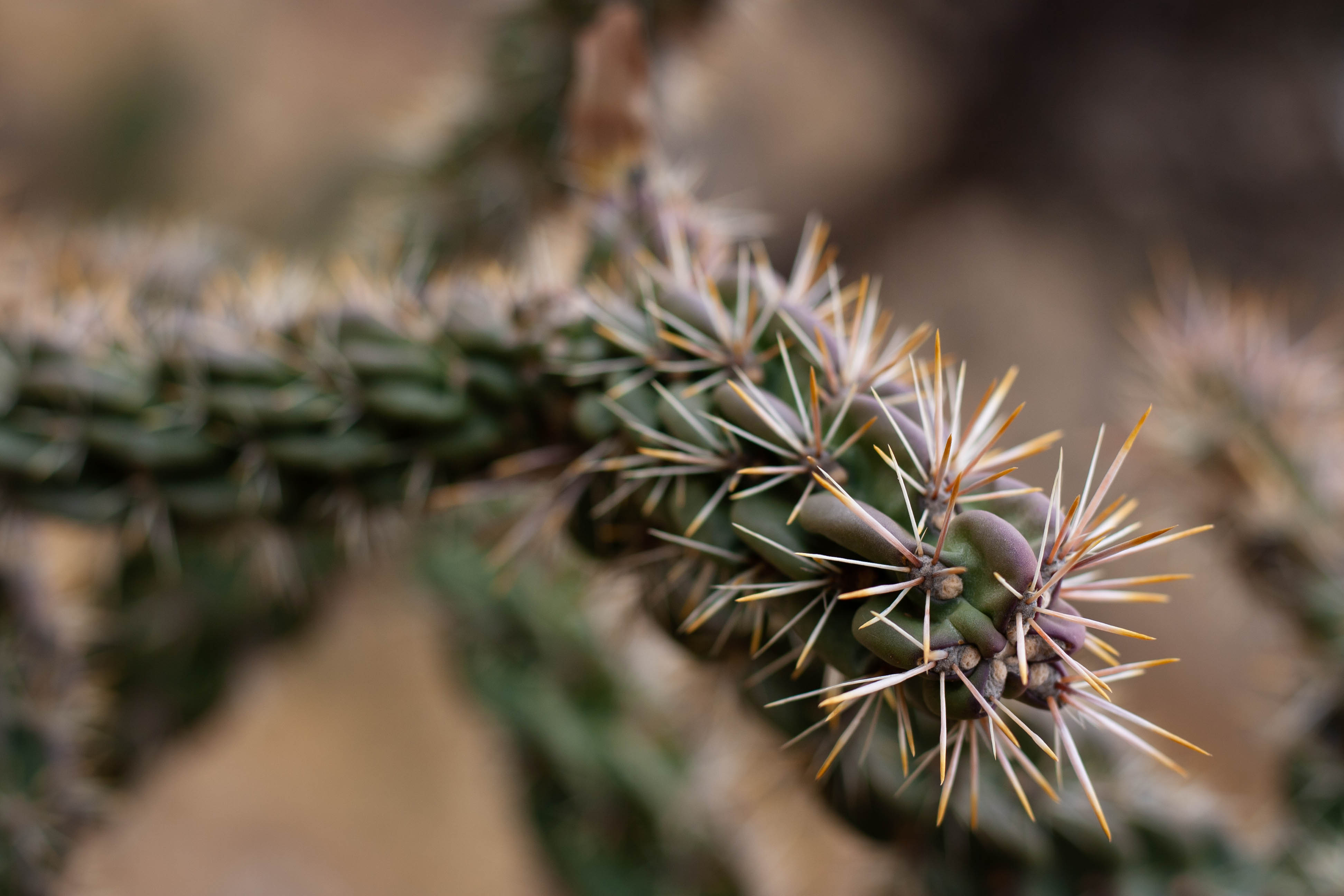
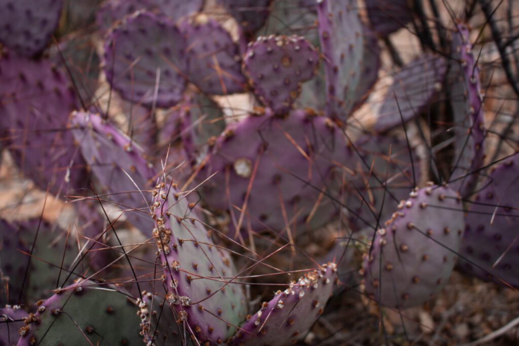
There are over 1,200 species of plants found in Big Bend. Blooming season stretches from March through October. Bluebonnets peak in February and March. Cactus bloom in April and May. There are many other wildflowers to see.
Rain and temperature determine blooming times. Summer monsoons bring out the color. And the rare winter rain causes superblooms the following spring.
There’s a whole bunch of plants that are photogenic all hell even outside blooming season.

Rivers, Rocks And The Night Sky
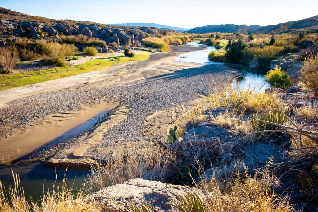
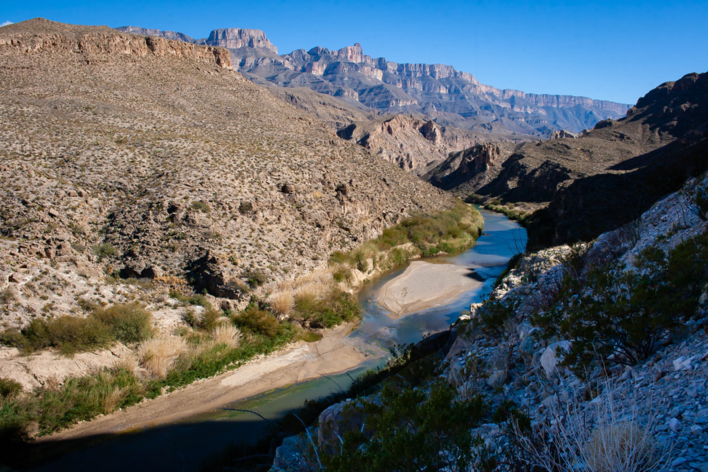
Technically there is only one river. But during monsoon season the washes fill up fast. Anywhere you can get up close to the Rio Grande is a potential photo spot.
Big Bend is a renowned dark park. This is an area that I need to branch into soon. Even with the naked eye, the stars are amazing.
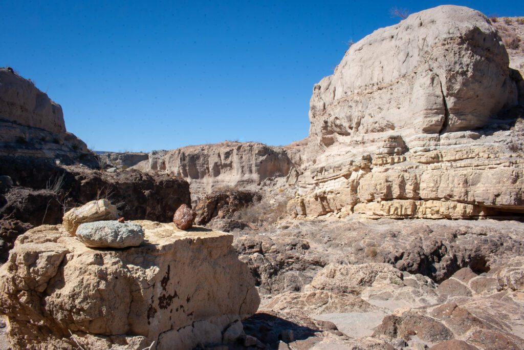
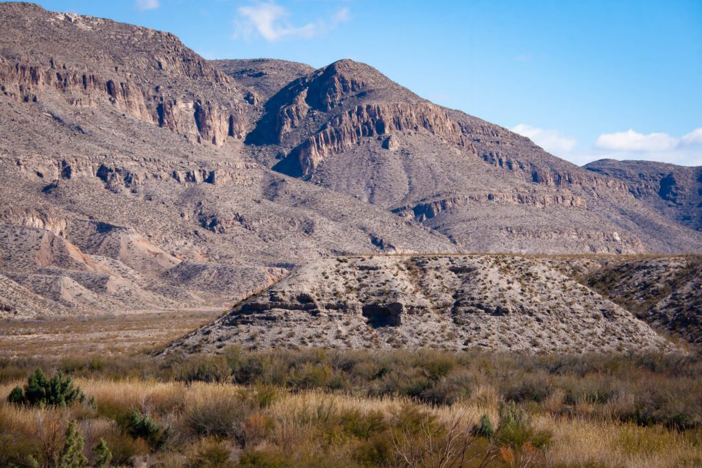
There are so many colors of rock. I’m such a sucker for striations. And there are fossils everywhere if you can peel your eyes from the greater surroundings.
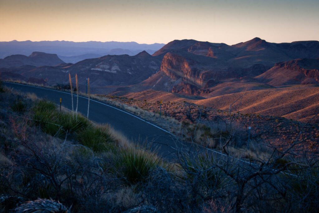
Sunrises And Sunsets
Big Bend absolutely glows during golden hours. Travel time within the park is a killer, so factor that in when planning your photo spots. I could’ve killed my copilot for holding me up when I wanted to leave!
West Side
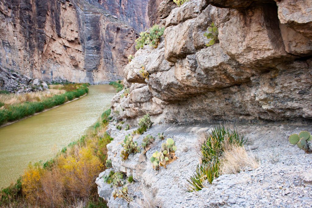
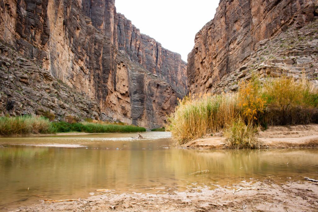
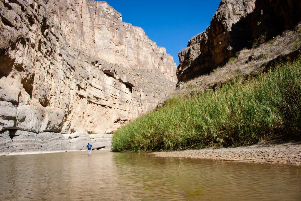
Santa Elena Canyon
Santa Elena is very iconic. You can’t go wrong with photos. I shot from the pull-off before its entrance, the beach, the short trail that goes in on the right, and the water. You can even get it in the background of others sites.
It’s easy to wade out into the river while its shallow in dry season. But be warned, it’s cold AF. If you’d rather paddle out, you’ll need a flotation device and park permit. More info here.
One more thought. I’m not sure how accessible the trail is during rainy season. I got wet up to my knees even at record low water levels.
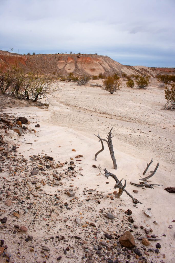
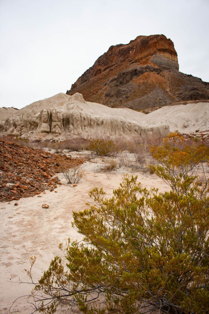
Ross Maxwell Scenic Drive
There are way too many photo ops along this road to list — historic sites, plants, canyons and rock formations. The problem is finding a place to park when something catches your eye.
Check out the Parking Spots tab in this map. There’s a really interesting unmarked spot just past Tuff Canyon. See the pictures below.
My favorite overlook is Sotol Vista.
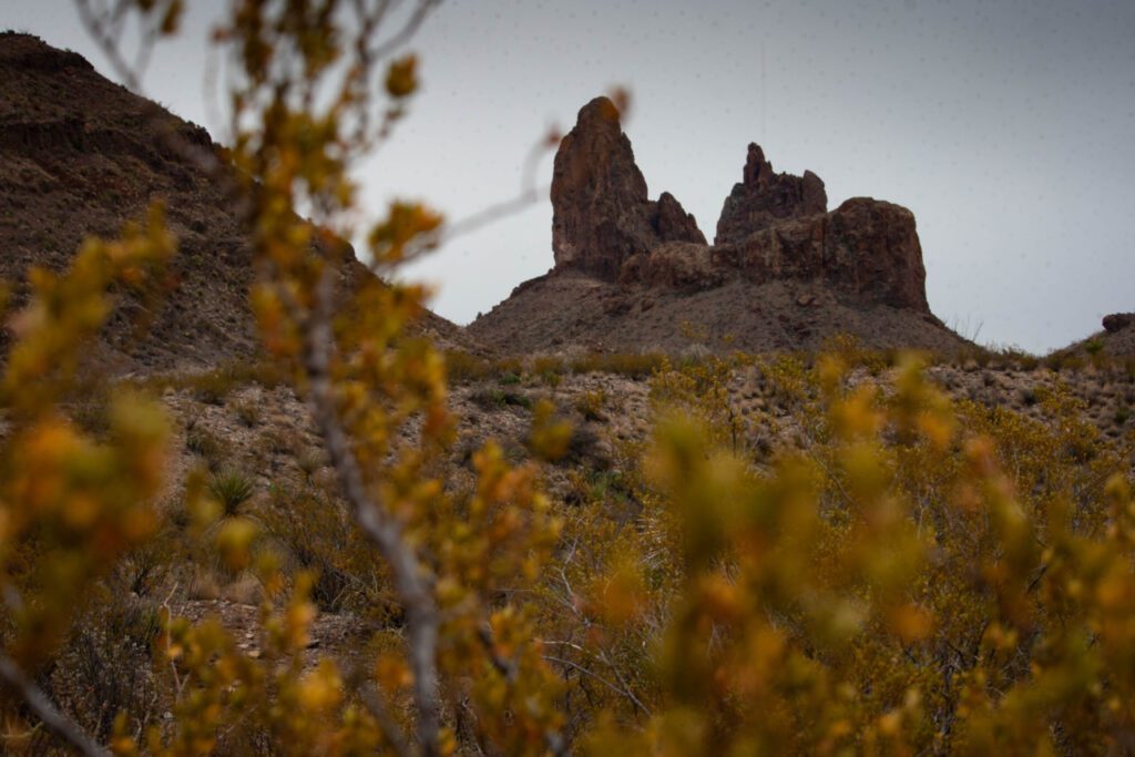
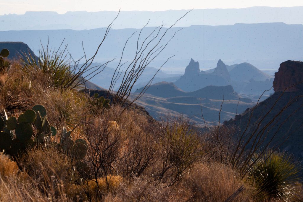
Mule Ears
Mule Ears is a distinct rock formation in Big Bend National Park. You can see it from the road, but there are much better views if you hike the Mule Ears Springs Trail out a ways.
We also saw some unique vantage points from the Dodson Trail that picks up behind Homer Wilson Ranch. It even snuck into the background of my phots on Emory Peak.
Central And Chisos Basin
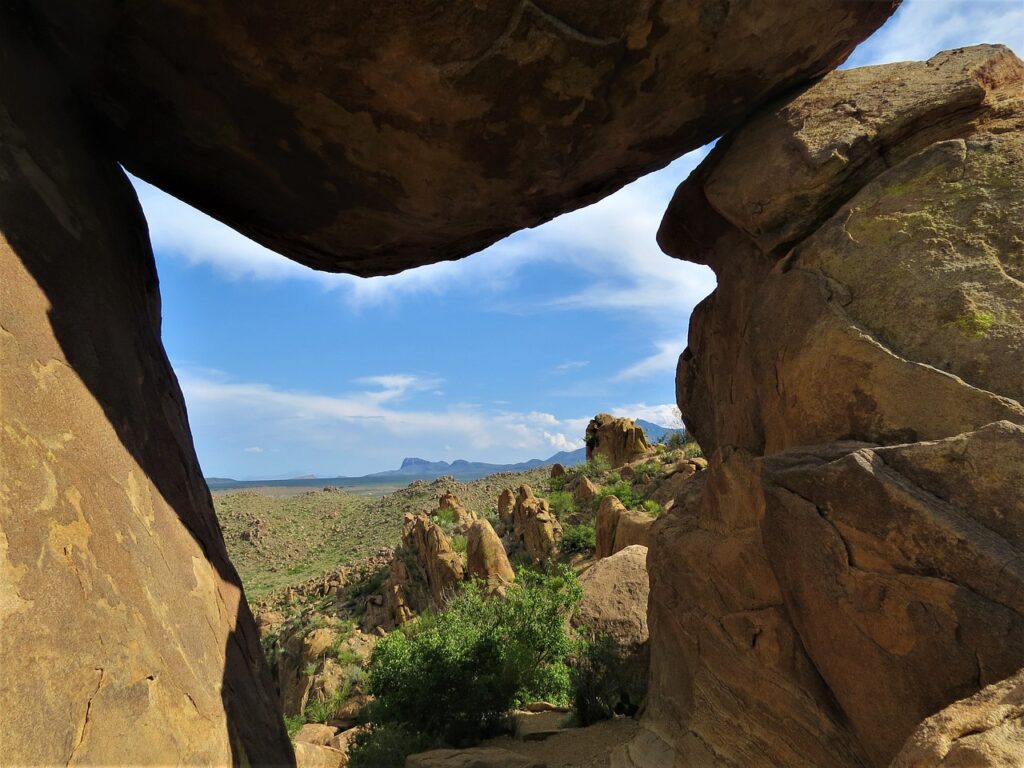
Balanced Rock
Balanced Rock seems to be the most popular photo spot in the park. If there wasn’t so much else to see and it was easier to get to, you bet your sweet ass I’d have done it.
The trail is short. But you have to traverse a 6-mile dirt road to get to the trailhead. The last stretch is a bit hairy if you don’t have high clearance. I would have rode my bike.
If you have an epic Balanced Rock photo that you want me to use below, contact me so we can get that puppy posted!
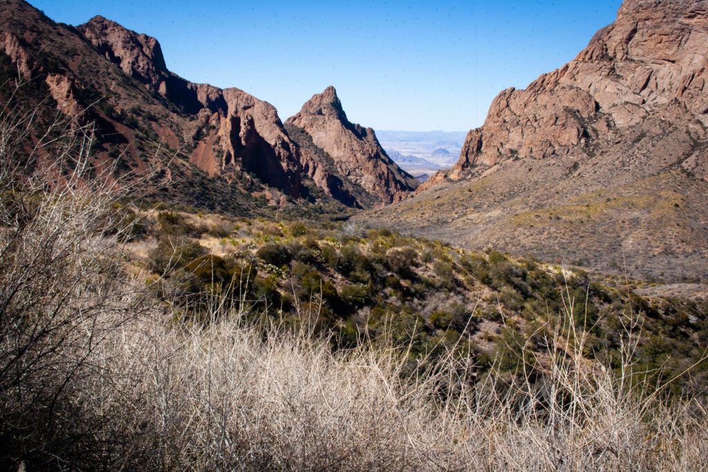
Chisos Basin
This is an interesting spot because its a bowl up in a mountain. It’s where the notorious Window is located.
In my opinion, the best vantage points are from just off the parking lot. That makes it convenient to check this one off the bucketlist. This is supposed to be a prized sunset spot.
If you want to avoid crowds, scamper off on the Basin Loop Trail.
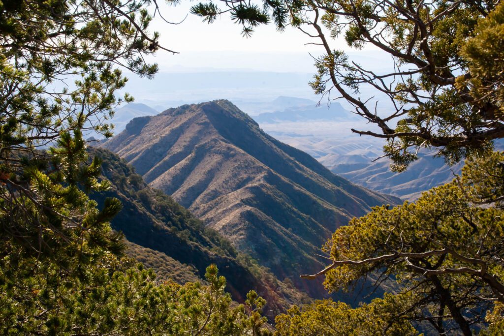
Lost Mine Trail
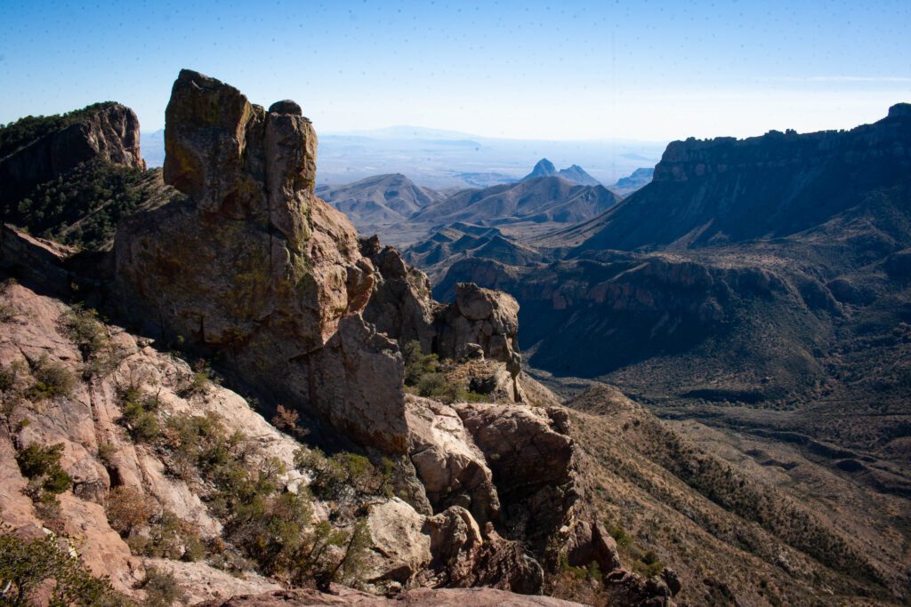
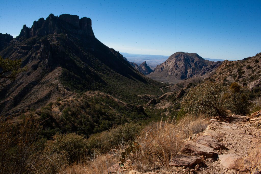
The end of the Lost Mine Trail might be my favorite spot in all of Big Bend. It blows anything in Chisos Basin and Santa Elena Canyon out of the water.
The trail is all uphill, but I wouldn’t consider it super steep. The top has to be experienced to see what I’m talking about. Abso-freaking-lutely stunning!
The end of the trail opens up and you are surrounded by unobscured views. There’s lots of opportunities to climb on rocks to check out all the angles.
Emory Peak
Getting to Emory’s Peak is a bit harrowing if you are scared of heights. You literally have to climb to get up there. We thought that was the best part, but if you don’t you can still see plenty before the climb.
It’s easy to lose the path towards the top. I got off track a few times which sucked.
We added the 3 mile detour to Emory Peak on our South Rim hike.
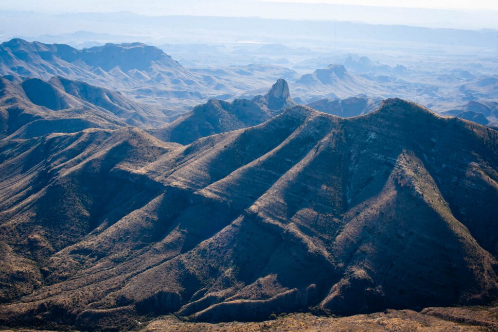
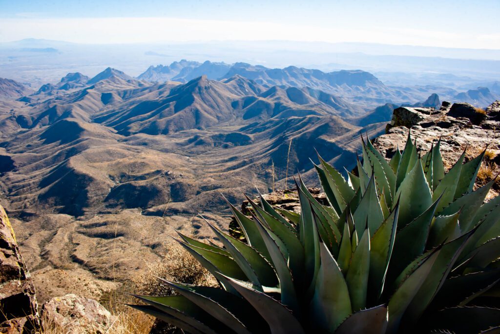
South Rim
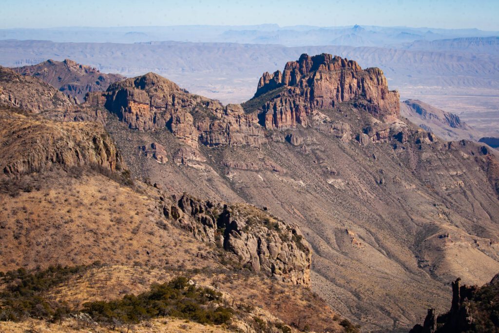
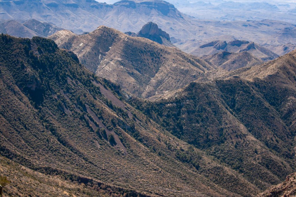
I definitely recommend heading in to South Rim from the east side. That way the views will get better as you go along.
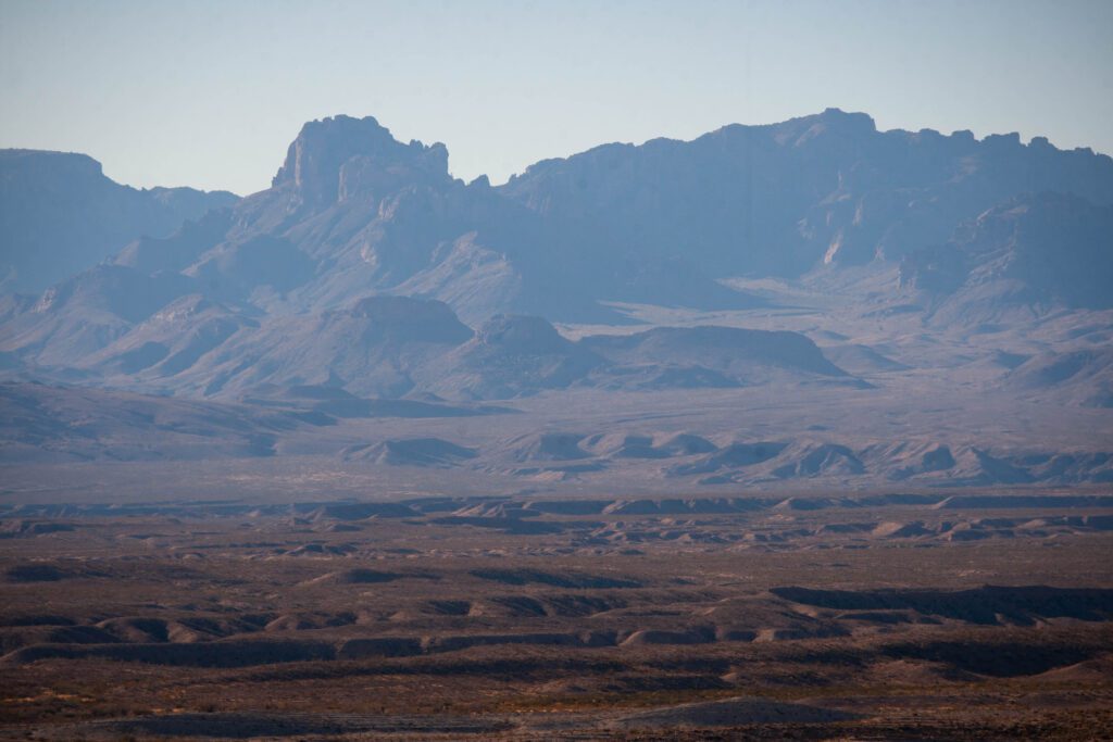
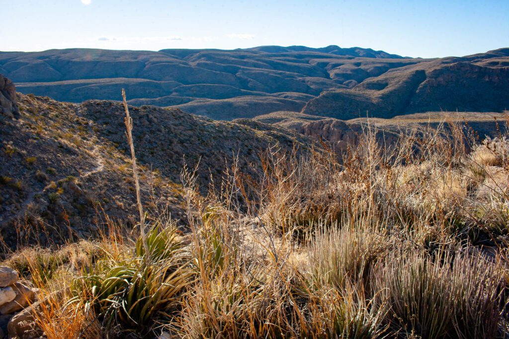
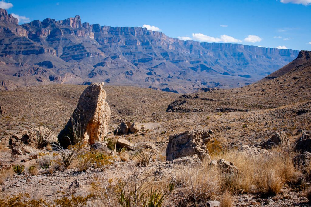
You can see all the distant ridge profiles as they fade off into the distance lands of Mexico. These are the kind of broad sweeping views that make my heart swoon.
East Side
Roadside Pull-Offs And Overlooks
The road from Panther Junction to Rio Grande Village isn’t as in-your-face scenic as Ross Maxwell. But the views towards the end are really awesome.
Find photo locations on this map.
Hot Springs Canyon Trail
The variation of views from this trail are spectacular. And they start in the parking lot at Daniels Ranch. You can even hop in the hot springs before heading back.
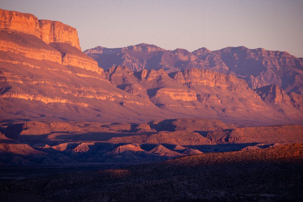
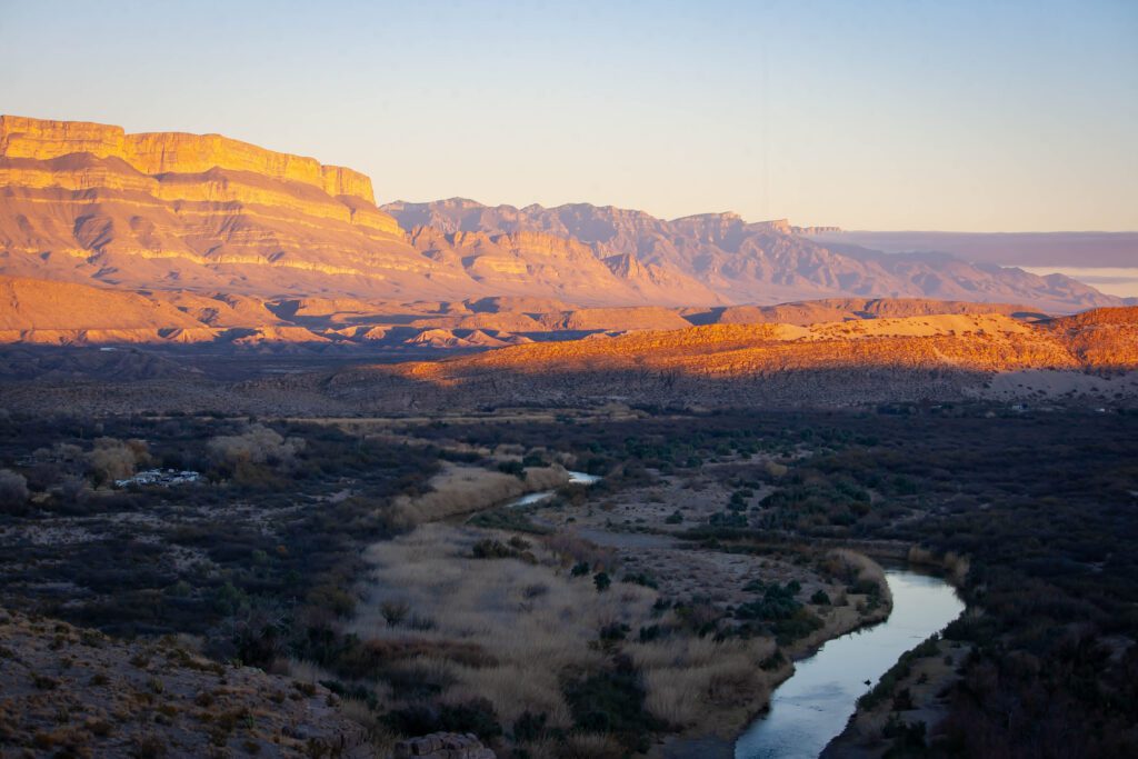
Photo opportunities include distant views of the Chisos Mountains, the Rio Grande, canyons, cool rocks and Mexican ridge face that glows fire pink at sunset.
Marufo Vega Trail
This trail is not for the faint of heart. It is hard as hell due to steep inclines, declines and loose rock. If you’re up for the challenge, you’ll be rewarded with some wicked cool views.
Want photos but don’t want to hike the whole thing? The rolling hills surrounding you on the first major ascent are mesmerizing. Can you see a hidden dragon?
If you push a little further, which I recommend, turn right at the loop fork. You’ll get some intense grandeur perspective of the distant ridge and gorge. Just be sure to turn back before the STEEP descent.
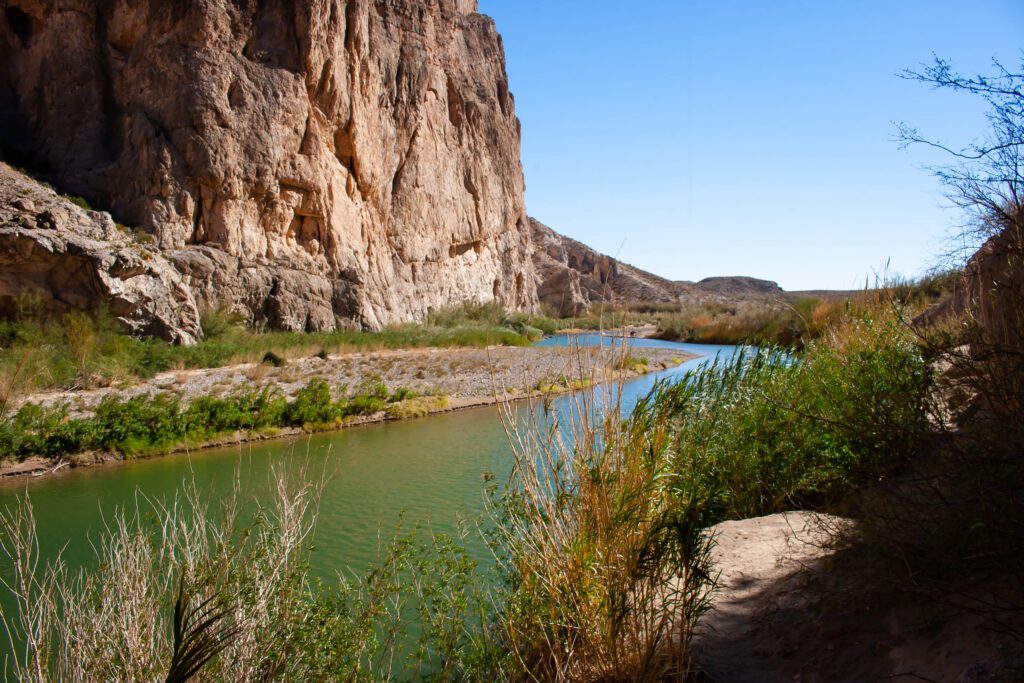
Boquillas Canyon Trail
Short and sweet. I especially liked all the green plants on the way into the canyon.
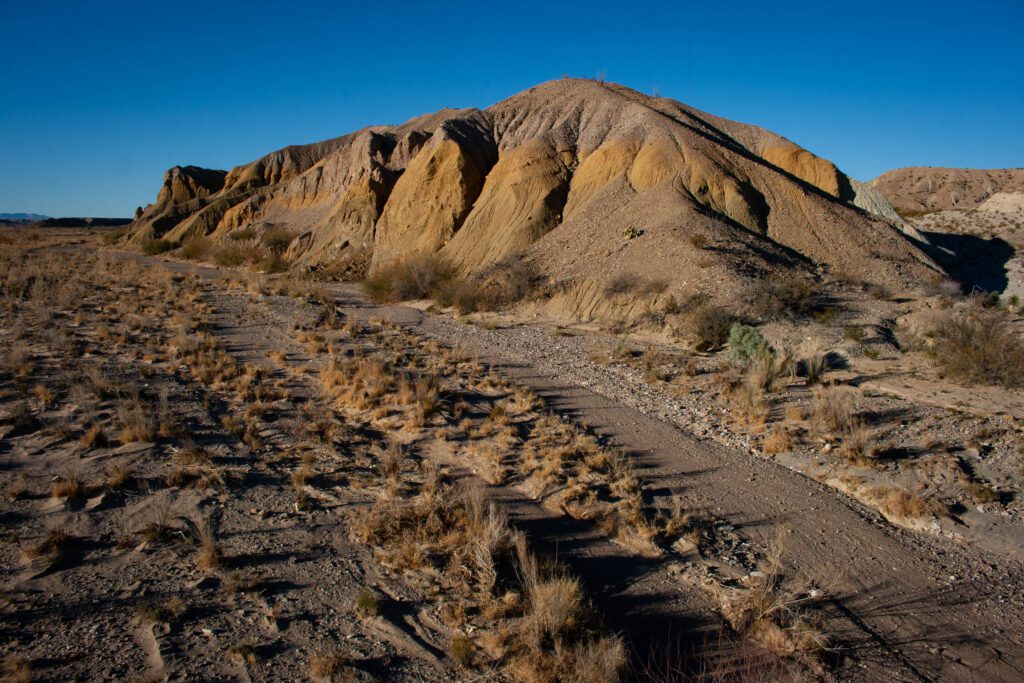
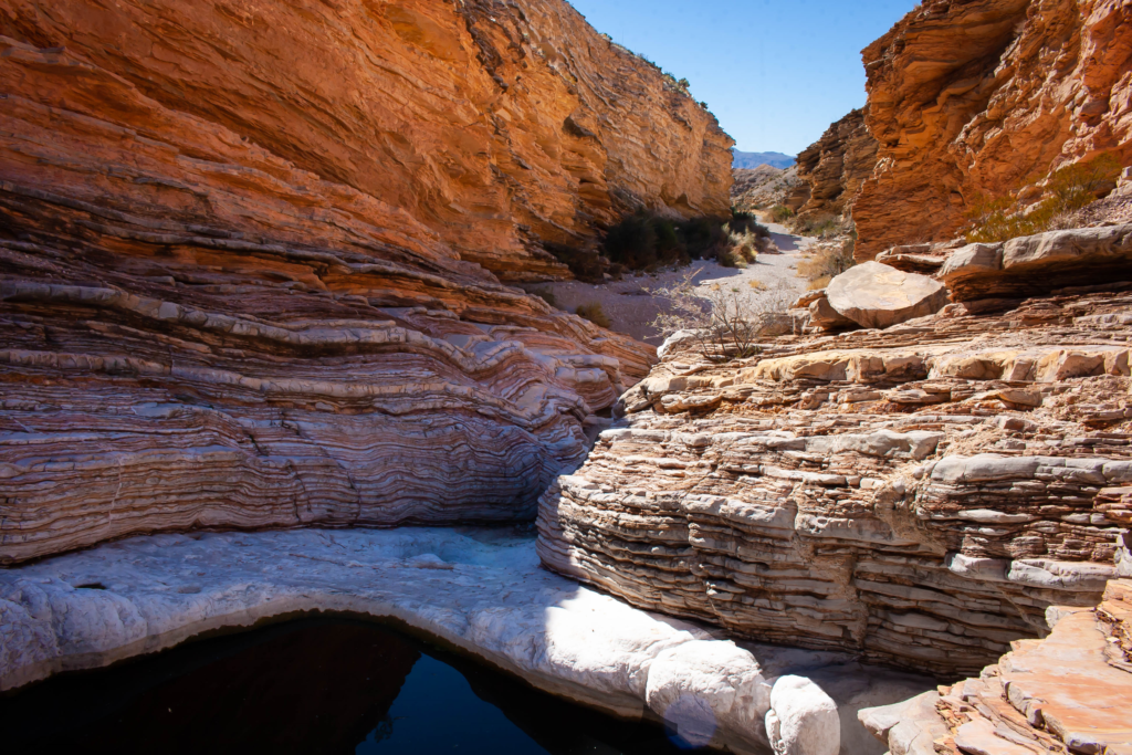
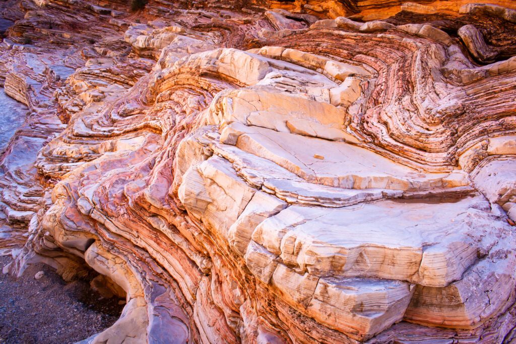
Ernst Tinaja
Ernst Tinaja is a royal pain in the ass to get to. But it’s well worth the trek because it’s so unique. A rock lover’s wet dream and I suspect great inspiration for artists.
The rock changes from a pinkish hue to white as you scramble further up the canyon. Just avoid the dark creepy water pools if they look gross.
You have to traverse 6 miles on the worst dirt road in the park to get to the trailhead. We didn’t want to risk messing up our van, so we rode bikes from the Rio Grande Overlook pull-off.
Let’s Make Things Fun!
Click to Download Photo Bucketlist
Click to Download Blank Photo Bucketlist
Click to Download Bingo Card
Looking For More?
Click over to our park planning info or our favorite trails list.